A forest seen from above can look like a continuous green blanket. Measuring its height, branches, and underlying terrain requires a different kind of view. NASA’s CASALS instrument is exploring a way to produce more complete three-dimensional maps by changing how laser light scans the ground.
In an October 21 technology update, NASA described an airborne prototype designed to address gaps between the narrow measurement tracks collected by existing space-based laser instruments. CASALS aims to gather a continuous strip of measurements across its flight path.
Its approach uses changing laser wavelengths and an optical grating to direct pulses at different angles. This reduces reliance on moving mirrors for steering the beam.
The prototype flew aboard a NASA aircraft in November 2024 and collected science-quality data. NASA reports that it can resolve fine vegetation details from an altitude of roughly five kilometres. Further development is planned, including a wider scanning swath and onboard processing.
The distinction is important: CASALS has demonstrated airborne measurements, but a space-ready version remains a future objective. It is not yet an operational satellite mapping Earth.
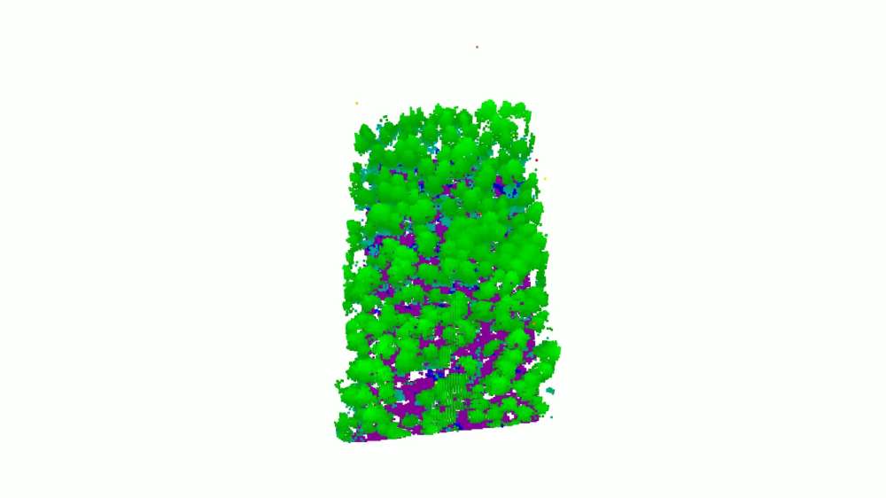
The underlying technology is lidar, short for Light Detection and Ranging. It measures distance using pulses of laser light. Combined with information about an aircraft’s position and orientation, those measurements produce a detailed collection of points representing surfaces below.
Each point has a position and height. Together, these “point clouds” can form digital terrain models, representations of buildings, or maps of vegetation structure.
Lidar already supports practical work, including shoreline mapping, coastal vulnerability analysis, emergency response, and flood modelling. Different instruments serve different purposes: topographic lidar commonly uses near-infrared light to map land, while bathymetric lidar uses green light that can penetrate water to measure submerged terrain.
CASALS illustrates how improvements to an established measurement technique could change what researchers can observe. A map’s usefulness depends partly on where measurements were actually taken. More continuous coverage could reduce the spaces where analysts must rely on estimates between observations.
That does not make every resulting map automatically complete or error-free. Measurements still need calibration, quality checks, and careful interpretation. Greater detail also creates a practical challenge: researchers must process and manage the information efficiently.
For people using maps, the benefits often appear far from the instrument itself. Better elevation information can support decisions about where water may flow, how landscapes are changing, or which areas need closer inspection.
The project shows why advances in optics and computing matter together. Collecting more useful measurements is one step; turning them into reliable information is what makes the technology valuable.